
Showing posts with label National Park. Show all posts
Showing posts with label National Park. Show all posts

paw paw tunnel, maryland
paw paw tunnel, in allegany county, md, is the second longest canal tunnel in the u.s. 

el yunque rainforest, puerto rico
puerto rico is home to the only tropical rainforest in the united states national forest system (weird, seems like surely there'd be one in hawaii too, no?)
there are a million hiking trails that lead through some of the most beautiful vegetation and views, but we decided to do the el yunque peak trail since el yunque peak is the highest point in puerto rico. there were also several side trails to observation towers and a crazy drop off/ledge that were short trips off the main trail... and totally worth the detour.
panoramic view from one of the observation towers;

a rain shelter on another one of the side trails;

los pinchos (the jagged peak) as seen from a side trail. i almost died of a heart attack after taking this photo when i looked down and realized i was standing literally on the edge of an extremely steep drop-off. no kidding. it's hard to tell in this photo, but the lighter green plants at the bottom of this picture are clinging on to the side of a cliff face, NOT growing out of the ground.

jen, back on the main trail to el yunque peak

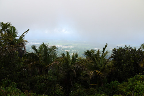
view from the top of el yunque. unfortunately, this spot is apparently always covered in clouds forming off the warm caribbean waters and cooling as they rise over the peaks... it was pretty awesome to see the sun shining in the distance surrounding us though, and then later back at sea level, looking back at the peak and seeing it constantly covered in clouds.

after el yunque peak, we did another, shorter hike, to a series of "hidden waterfalls" -- they aren't super hidden since i easily found directions on the internet before our trip, but they also aren't marked well on the maps and the trail isn't officially blazed. also, the term hike isn't exactly appropriate, it was really more like muddy rock climbing. i'm pretty sure this is when we had an unfortunate encounter with a poisonous plant that, two weeks later, has still left a painful rash on our arms.
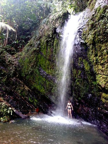
the muddy climbing and poisonous plants were totally worth it though, because we ended up at this 40ft waterfall and swimming hole that we had all to ourselves. we didn't even bother going to la mina, which is the main tourist attraction because this spot was so awesome.

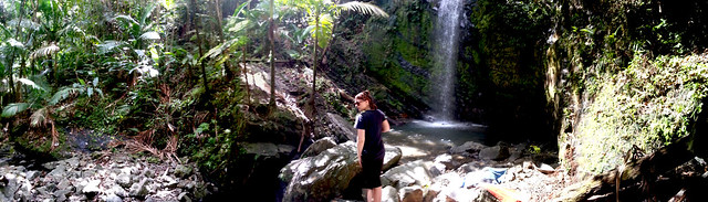
panorama view of the falls... the big rocks in front of jen are concealing a smaller waterfall that led further back down the mountain

there are a million hiking trails that lead through some of the most beautiful vegetation and views, but we decided to do the el yunque peak trail since el yunque peak is the highest point in puerto rico. there were also several side trails to observation towers and a crazy drop off/ledge that were short trips off the main trail... and totally worth the detour.
panoramic view from one of the observation towers;
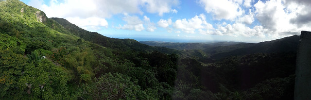
a rain shelter on another one of the side trails;

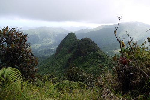
los pinchos (the jagged peak) as seen from a side trail. i almost died of a heart attack after taking this photo when i looked down and realized i was standing literally on the edge of an extremely steep drop-off. no kidding. it's hard to tell in this photo, but the lighter green plants at the bottom of this picture are clinging on to the side of a cliff face, NOT growing out of the ground.
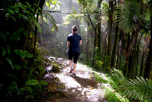
jen, back on the main trail to el yunque peak
view from the top of el yunque. unfortunately, this spot is apparently always covered in clouds forming off the warm caribbean waters and cooling as they rise over the peaks... it was pretty awesome to see the sun shining in the distance surrounding us though, and then later back at sea level, looking back at the peak and seeing it constantly covered in clouds.
after el yunque peak, we did another, shorter hike, to a series of "hidden waterfalls" -- they aren't super hidden since i easily found directions on the internet before our trip, but they also aren't marked well on the maps and the trail isn't officially blazed. also, the term hike isn't exactly appropriate, it was really more like muddy rock climbing. i'm pretty sure this is when we had an unfortunate encounter with a poisonous plant that, two weeks later, has still left a painful rash on our arms.
the muddy climbing and poisonous plants were totally worth it though, because we ended up at this 40ft waterfall and swimming hole that we had all to ourselves. we didn't even bother going to la mina, which is the main tourist attraction because this spot was so awesome.
panorama view of the falls... the big rocks in front of jen are concealing a smaller waterfall that led further back down the mountain
paterson great falls national park, paterson, nj
paterson great falls in nj is one of the largest falls in the u.s. the falls were formed almost 13,000 years ago at the end of the last ice age, and cut through basalt that was formed nearly 200 million years ago.


civil engineer charles l'enfant (designer of washington dc's layout) designed the system of canals known as a raceway, that supplied the nearby watermills. this 4,849 kilowatt/hr hydroelectric facility, designed by colt (of colt revolvers) based on a l'enfant design, operated from 1914 to 1969. in 1984, the plant was restored, restarted two years later, and now produces 11,000 kilowatts/hr.

civil engineer charles l'enfant (designer of washington dc's layout) designed the system of canals known as a raceway, that supplied the nearby watermills. this 4,849 kilowatt/hr hydroelectric facility, designed by colt (of colt revolvers) based on a l'enfant design, operated from 1914 to 1969. in 1984, the plant was restored, restarted two years later, and now produces 11,000 kilowatts/hr.
ruins of the allied textile printers and colt revolver mills, paterson, nj
paterson great falls national historic park is the site of several mills dating back to the 18th, 19th, and 20th centuries.
ruins of several of these mills still exist today, including the allied textile printers mill as well as the colt revolver mill.
below, the allied textile printers mill was constructed in 1836 and remained in operation until the 1980s when a fire destroyed the mill.


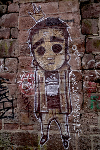
below, some grafiti on the side of the colt revolver mill ruins. the mill was built in 1813.
ruins of several of these mills still exist today, including the allied textile printers mill as well as the colt revolver mill.
below, the allied textile printers mill was constructed in 1836 and remained in operation until the 1980s when a fire destroyed the mill.
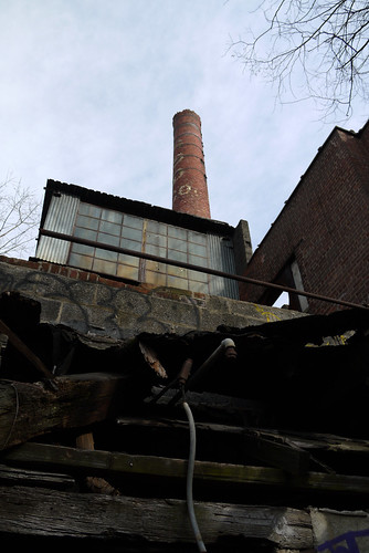
below, some grafiti on the side of the colt revolver mill ruins. the mill was built in 1813.


Floyd Bennet Field and Ft. Tilden
One of my favorite places in NYC (see previous posts on this area here: March 2005 and February 2009)
This time we went on a beautiful, grey foggy day.

This time we went on a beautiful, grey foggy day.
jacob riis, ft. tilden
there is a lot to see on rockaway peninsula. we only had a few hours to check things out, but more trips are in order before summer and the return of the beach crowds.
first stop was jacob riis. the old robert moses comfort stations look years abandoned instead of merely closed for the season. it's amazing what salty, damp wind does to these structures.

first stop was jacob riis. the old robert moses comfort stations look years abandoned instead of merely closed for the season. it's amazing what salty, damp wind does to these structures.


Subscribe to:
Posts (Atom)