fall weekends in new paltz (pt. 2)

My last post about New Paltz was getting a little long, so I decided to break it up into two parts. These pics are from several different trips.


fall weekends in new paltz (pt. 1)

I'm a little late to the game, and after years of going upstate, only recently "discovered" New Paltz. While I love the Catskills and Adirondacks, it doesn't always make sense to make the drive for short weekends. Fortunately New Paltz is just over two hours away, a reasonable drive for those weekends when you only have one free night to get away.


dumbo arts fest 2013

While this year's D.U.M.B.O. Arts Fest had some really great installations, it fell a little short compared to last year's.

We still had a great time though and glad we went.

This was pretty cool -- An image of birds on a telephone wire was projected onto several walls in the corner of a warehouse, and when you called the number at the bottom left, you got a recording of birds squawking and the birds flew off the wire in the projection. 


hangar b at floyd bennett field

For all the times I've been to Floyd Bennett Field, I'd never managed to get there when Hangar B was open...

...until a few months ago!


governor's island fete paradiso

A few months ago, my friend Lisa and I celebrated her birthday with a trip to Fete Paradiso on Governor's Island.


roadtrip rehash: day 7, 8, and 9 (yakima to salish lodge, and seattle)

From Yakima, we continued our drive north and west, across the Cascades and into Snoqualmie. We passed through North Bend on our way,  past the diner from Twin Peaks.


To "celebrate" the end of our trip, we stayed at Salish Lodge for a night of pampering massages, hot tubs, whirl pools, and saunas. The hotel itself (which you might recognize as The Great Northern Hotel from Twin Peaks), is set atop the powerful and beautiful Snoqualmie Falls and has a great calming retreat feel.


(our in-room jacuzzi!)


(and in-room wood-burning fireplace!)


We spent the next day ordering room service brunch and drinking coffee in front of a roaring fire, then drove back to Seattle to meet some local friends for drinks, followed by our flight home the next morning with a great view of one of the Cascade peaks.


roadtrip rehash: day 6 (bend is the best, lava everywhere, chasing waterfalls, smith rock, and the long drive to yakima)

Wow, I'm really behind! We got back from this trip over a month ago, and I'm just now getting around to posting the last photos from it. 'Tis the season ;)

The sixth day of our trip was spent in areas largely affected or created by volcanic activity.

Our first stop was a national park fifteen minutes outside of Bend called Newberry National Volcanic Monument -- Lava Lands Visitor Center. The visitor center was actually closed already for the season (we knew this would be the case ahead of time), but the hikes behind it across a large lava field were open to visitors. Apparently the NPS didn't think to put up "closed due to government shutdown" signs since the center was already technically closed, because we didn't see any attempt at road blocks or orange cones.


After walking around the paved paths of the lava field at Lava Lands, we drove 45 minutes further down the road to our next stop, the Big Obsidian Flow.

At first, the Big Obsidian Flow just looked like a taller version of Lava Lands...


...but upon closer inspection, we realized the flow was actually made up of much different rocks than Lava Lands.


We spent a little over an hour wandering around what felt like a big portion of the flow. But when I was looking up info for this post, I came across this aerial view of the flow (cool huh?) and realized we really only saw a tiny portion of it. The photo two above (with our hands holding obsidian) shows the "end" of the flow and how it came to rest, and is circled in yellow below. The extreme end/left of the photo below is the origination end.


Less than five minutes' drive from the Big Obsidian Flow was our next stop, Paulina Falls.


From Paulina Falls, we headed north, back to Bend, for a quick lunch and souvenir shopping stop. Bend is an adorable town, and after our experience at Zydeco Kitchen and our lunch stop the next day at Plankers Sandwiches, safe to say also a town with amazing eating options.

It also had a great, easy-going feel, as evidenced by this store sign:


From Bend (round two), we continued our drive north to Smith Rock State Park in the High Desert Region of Oregon. Since I'm kind of behind on posting, I don't want to get too into the geology of the place, but essentially it was formed by a volcanic eruption and then some extreme weathering and erosion.


After Smith Rock, we drove north to Yakima, through eerily beautiful fields of windmills. They didn't really translate well to photos, but you can sort of make out the rows of red lights.


roadtrip rehash: day 5 (portland sucks, breitenbush hot springs, clear lake)

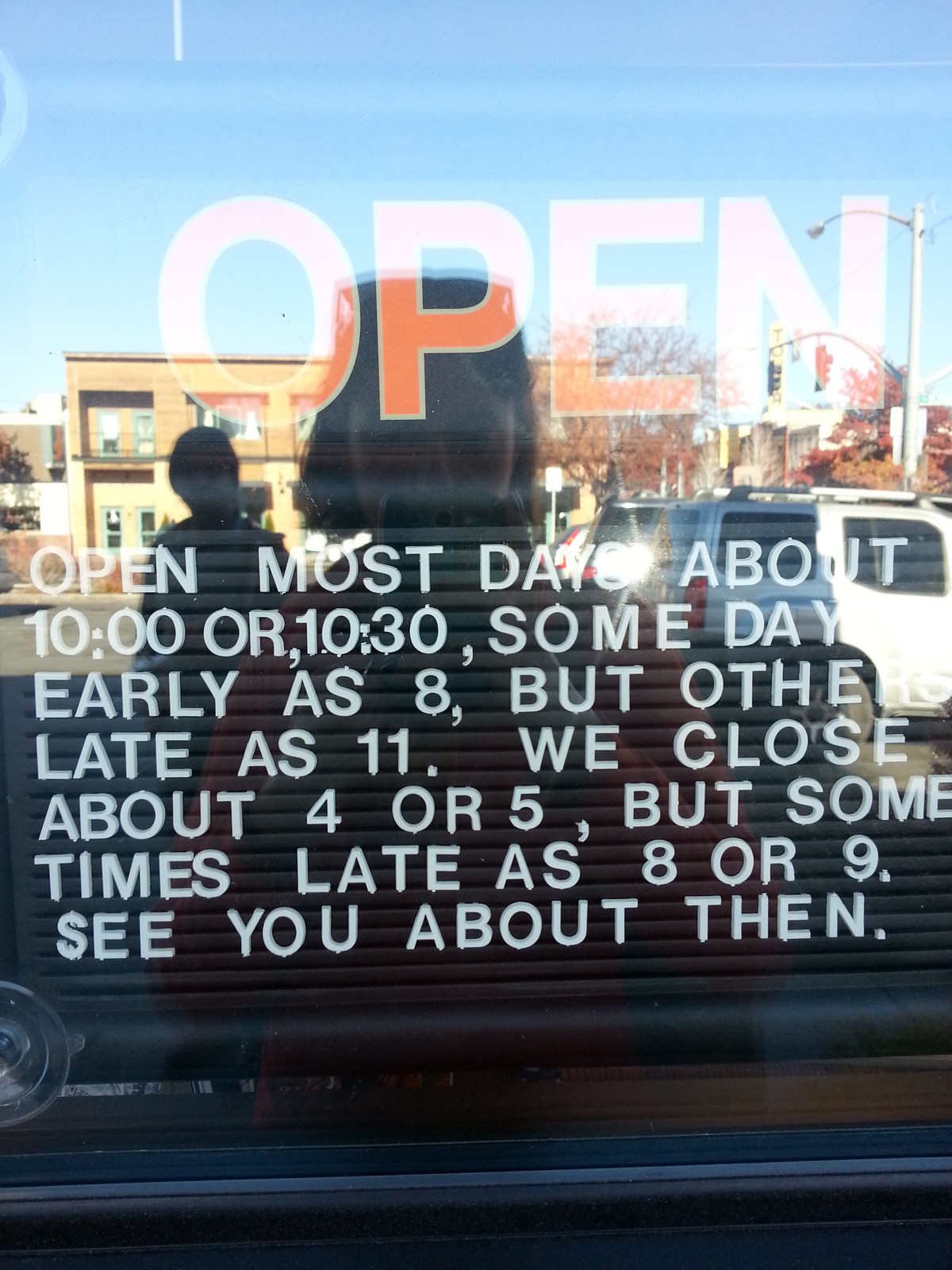
After a weird night of weird bars and weird beers (and one tasty sour beer), we checked out of our weird hotel in weird downtown Portland.

I could go into detail about why Portland was weird (BAD weird, to be clear) but I'll spare you and just say the city is lacking....

Anyway. While waiting for the car to be brought around, I ordered a breakfast sandwich from the cafe downstairs of the hotel, and this sandwich would be the one redeeming aspect of Portland. This sandwich was by far, the most delicious breakfast sandwich I've ever eaten in my entire life. Called the PDXWT (from Portland Penny Diner) , it featured duck bologna, sauerkraut, coffee mayo, egg and cheese. And it was insane. 

Obviously, to balance out all the savory, our next stop was an international tourist attraction known for sweets.


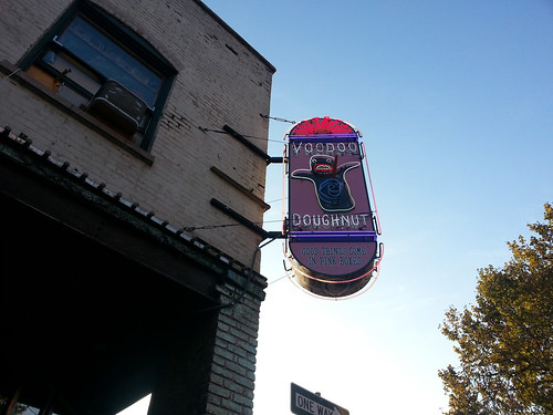
We decided to get two "real" choices (donuts we thought we'd actually like) as well as two "experimental" choices (donuts this place is known for that are more gimmicky than delicious.)


Our two "real" choices; the bacon maple bar (self explanatory) and the "Memphis mafia" (fried dough with peanut butter, chocolate, and bananas) were pretty great.

Our two "experiment" choices; the "Captain my captain" (captain crunch topping) and bubblegum donut (vanilla frosting, bubblegum "dust", and a piece of bubble gum) were interesting but nothing we could eat more than a bite of.

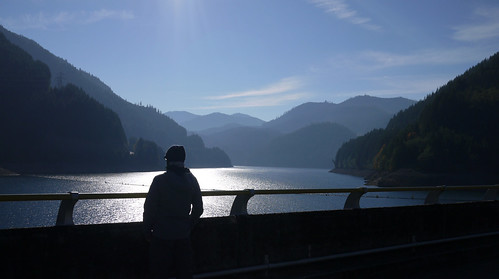
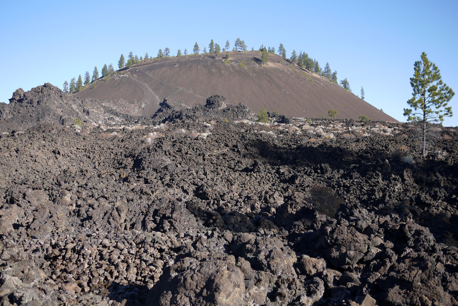
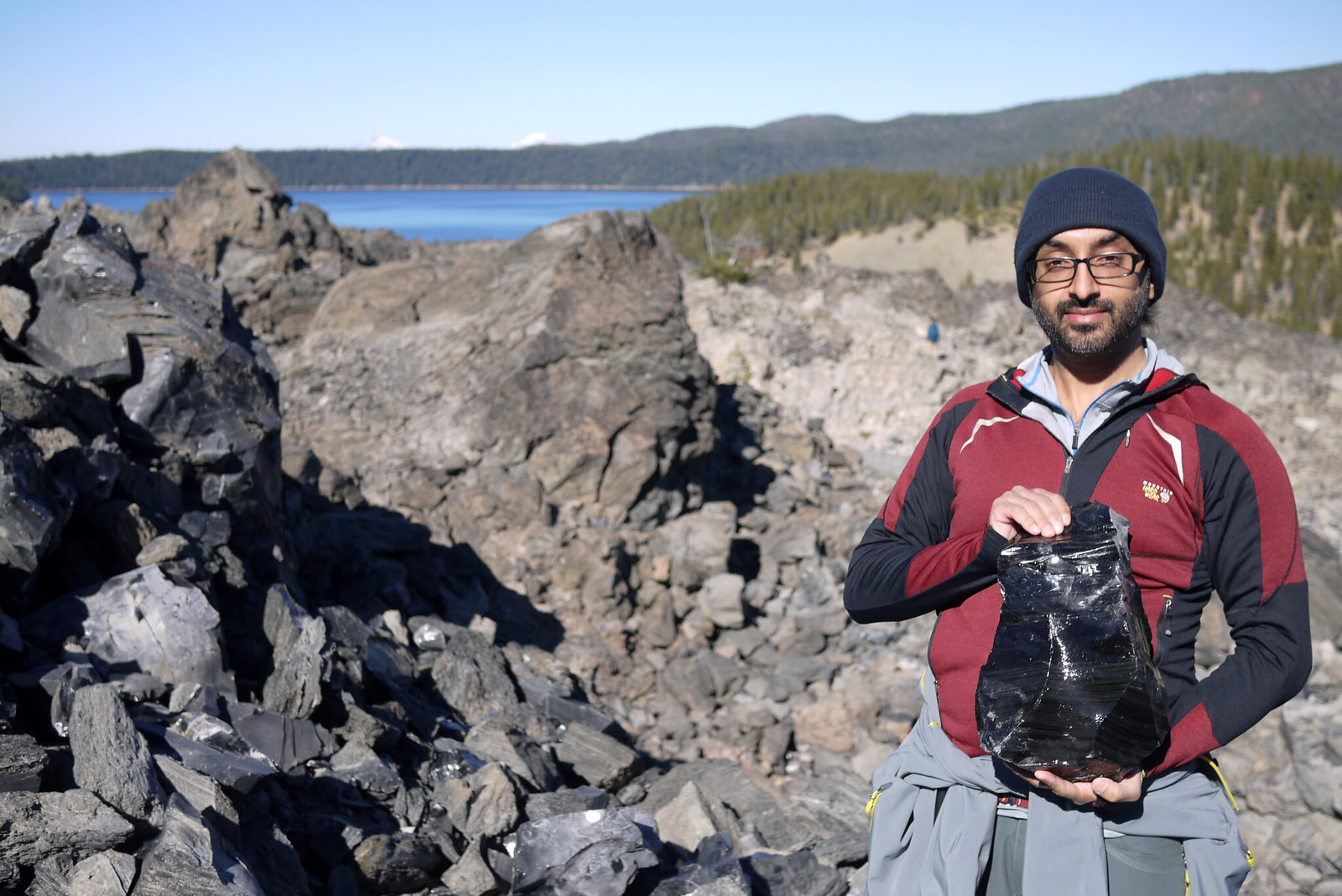
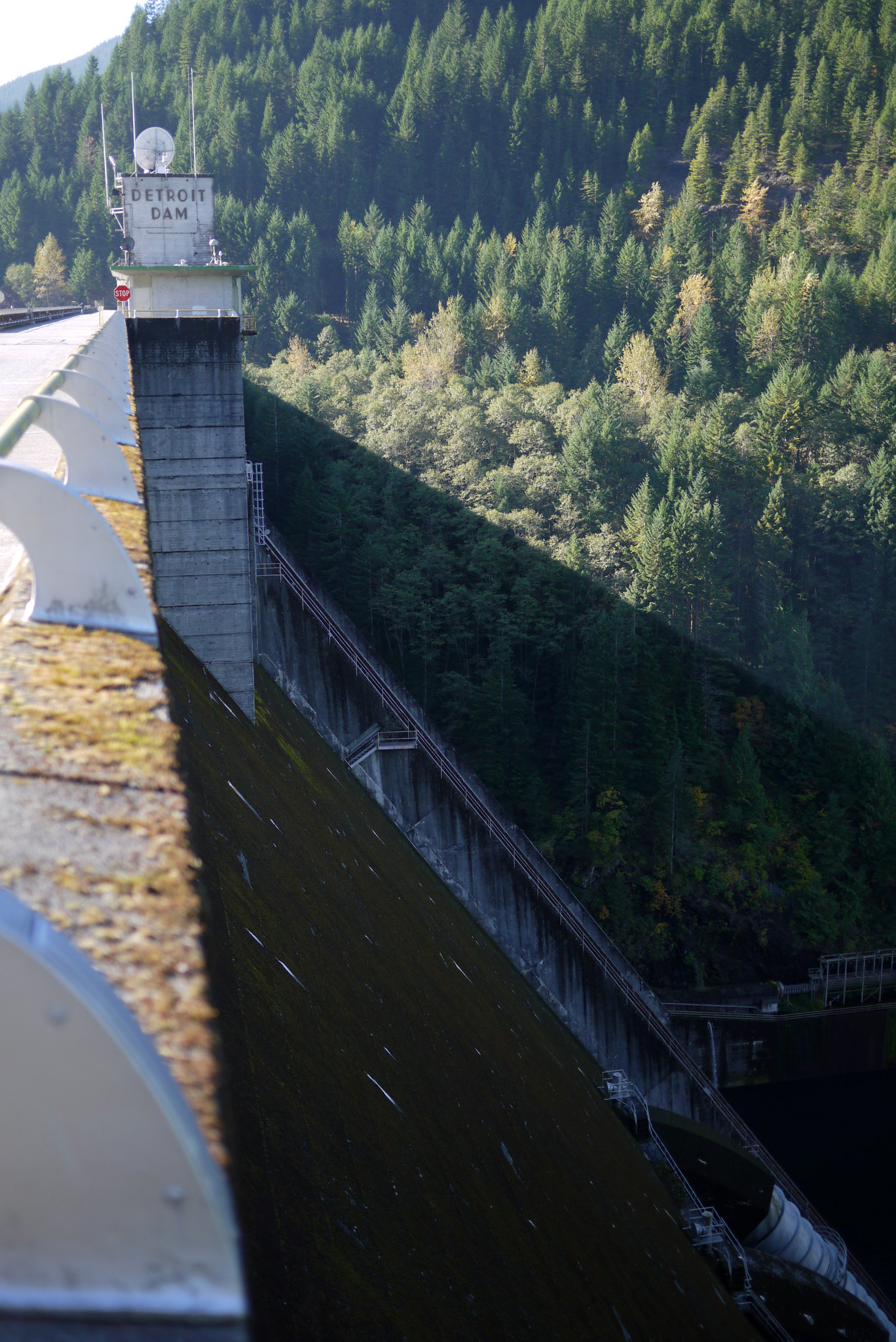
With our newly acquired sugar high, we drove off through the Oregon Cascades toward our next destination; Breitenbush Hot Springs. On our way, we passed signs for the Detroit Dam, and decided to stop and check it out. It was very cool and well worth the stop.


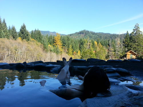
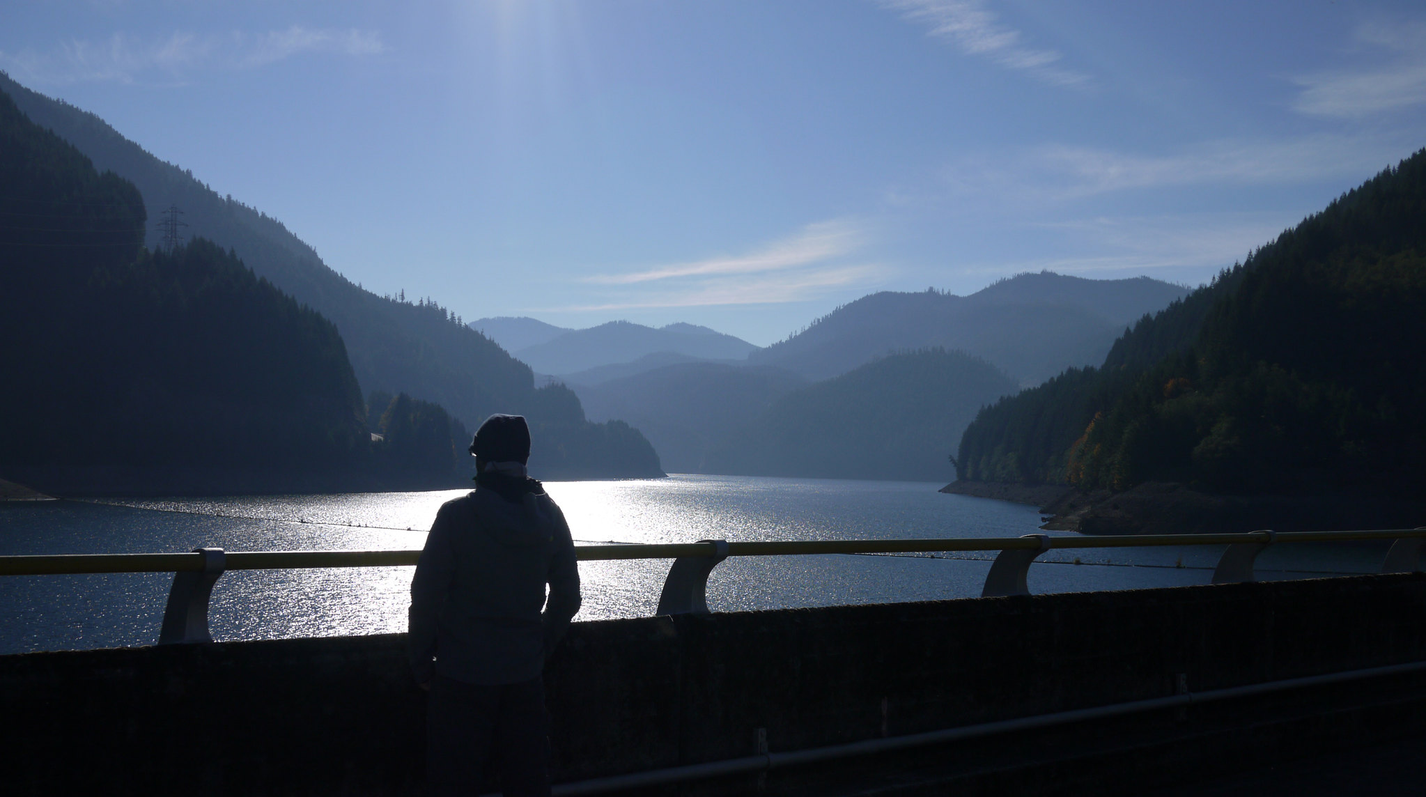
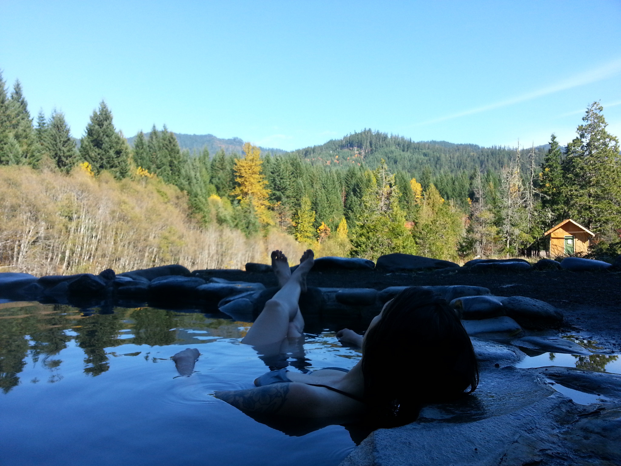
We eventually made it to the hot springs. Breitenbush required advanced reservations, and when we were planning this stop on the trip, we had a lot of hesitation about the resort. Their website makes it look like a commune of naked hippies, hanging out in hot springs, doing yoga, and eating vegan food all day --- which sounds perfectly wonderful --- but also hygienically questionable. Fortunately, Breitenbush is completely legit, with impeccable, spotless facilities (they empty and clean the tubs several times a day, and were vacuuming the library in the main lodge when we arrived.) We spent the late morning soaking in the 109º mineral springs overlooking the Cascades, rinsing in freezing cold mountain water, and steaming in a hot house, followed by a really great vegetarian lunch on the deck of the resort's main lodge.


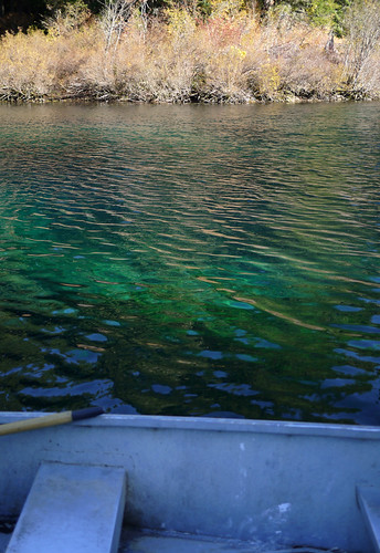
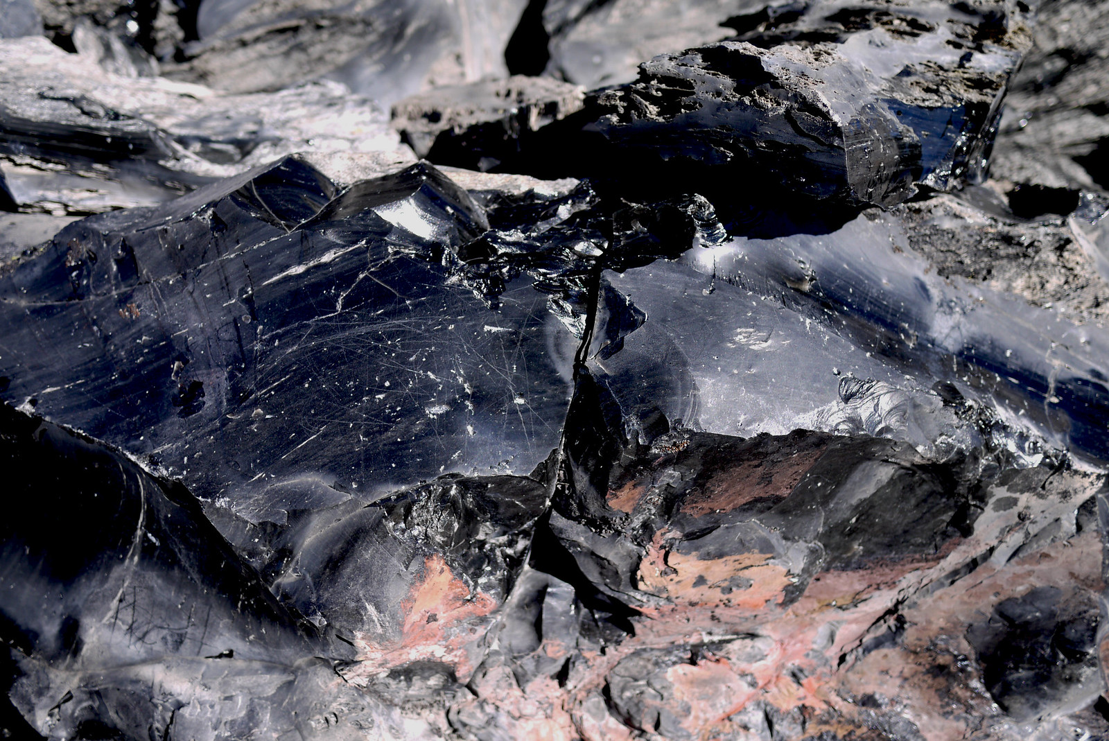
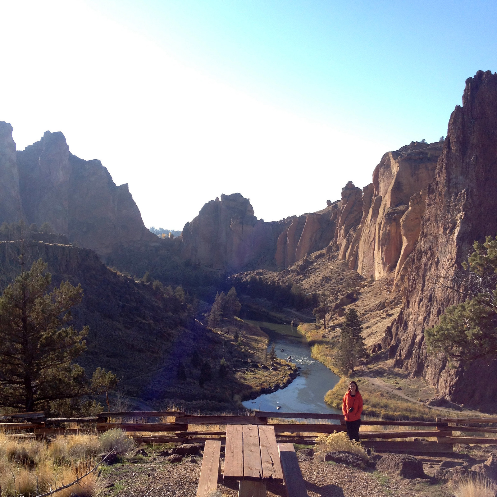
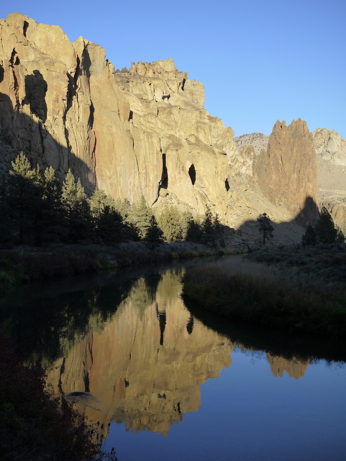
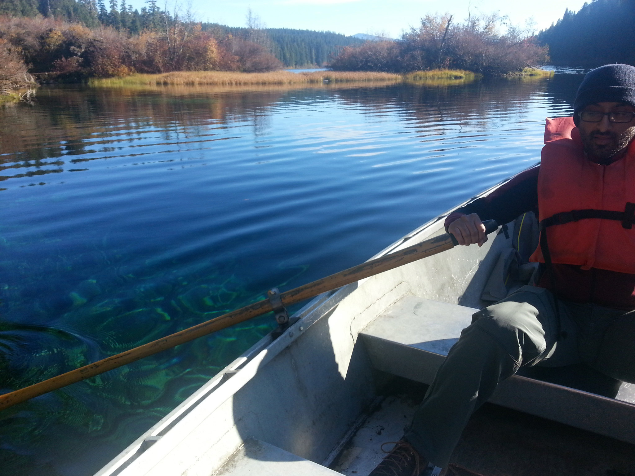
After Breitenbush, we headed further south and east to Clear Lake. As of May 2010, there are actually 11 bodies of water in Oregon referred to as "Clear Lake, " but this specific one is the one nestled 3,000 ft above sea level in the Cascades of Linn County. Clear Lake gets its name from the crystal clear, almost transparent water that fills its basin. The water here is particularly clear for several reasons, mainly because it is spring fed, but also because its bottom is covered in ash from a volcanic eruption roughly 3,000 years ago (limiting the number of algae, etc that will grow in it.)

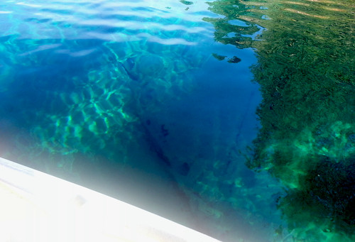
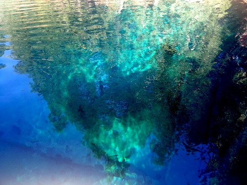
It's these same conditions that allow a stand of tree trunks to be preserved in their upright position, submerged under 100+ ft of water. These trunks are the remains of ancient trees that were inundated by the volcanic explosion. As you can see in the next few photos, the water is so clear, that even in the deepest parts, where the water measure 175 ft deep, you can still see straight down to the bottom.


Now, anyone who knows me knows that I have two great fears in life (1) spiders and (2) things in water that wouldn't be there naturally (usually manmade things like pool lights, docks, shipwrecks, drains, etc) this fear gets multiplied exponentially in deeper water. While the spider thing has a pretty obvious explanation (they're gross, fast, and unpredictable), the water thing is something I've never been able to understand. I love water (I love scuba diving and snorkeling!! I'm a strong swimmer!!!), I love creepy things, and I love exploring... so why when those things are combined, am I rendered into a useless blob of pure fear? Who knows.

Anyway, I only mention this fear because the next few photos show Jay patiently rowing me around the lake in between my bouts of extreme fear and irrationality. I'm not exaggerating when I say I was completely out of my mind for the majority of this experience. I gave Jay unintelligible directions about where to row the boat, I couldn't make any decisions or form complete thoughts (Jay:"Allison, do you want to go back to solid land?" Me:"Ummm, I dunno? Coffee grounds?") 


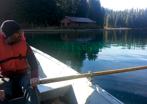
After these two shots, my photos got progressively blurrier as I basically closed my eyes and pointed my phone blindly at the water hoping I'd at least be able to see what I was sitting on top of at a later point in time when I wasn't so paralyzed with fear.


(Come on, you have to admit it's a little creepy to see the semi-recognizable outlines of trees and realize they're ONE HUNDRED SEVENTY FIVE feet down below the surface of the water.)

When we finally decided we'd had enough (me of the fear, and Jay of me complaining about my fear), we got back in the car and headed towards Bend.

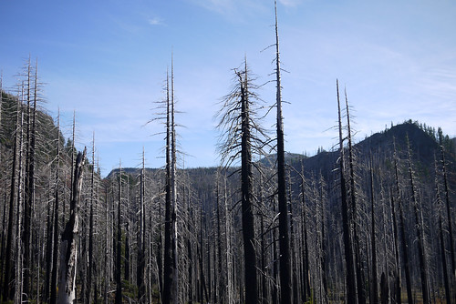
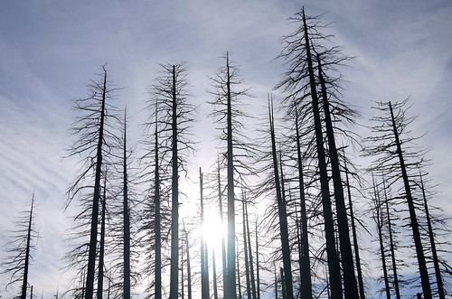
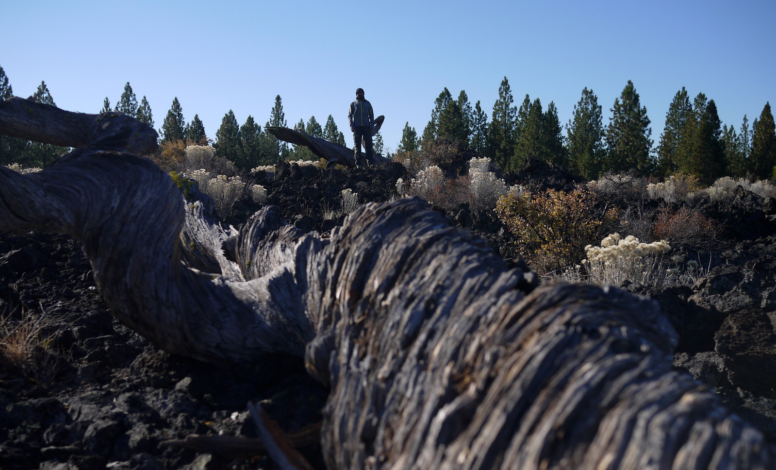
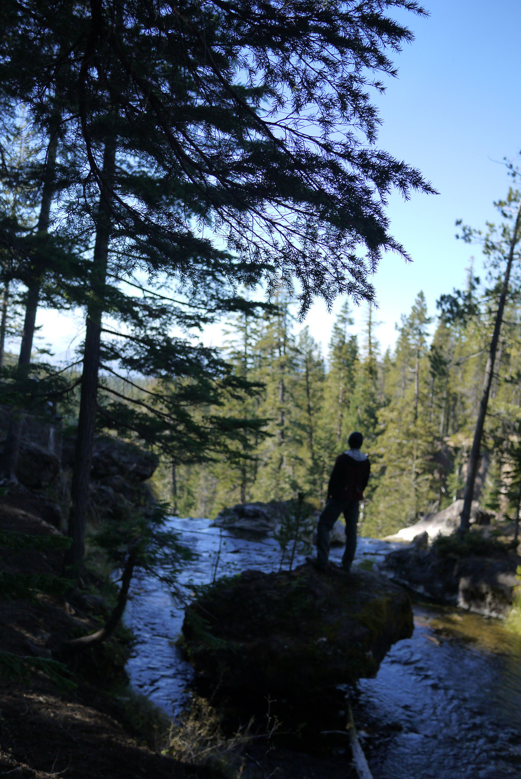
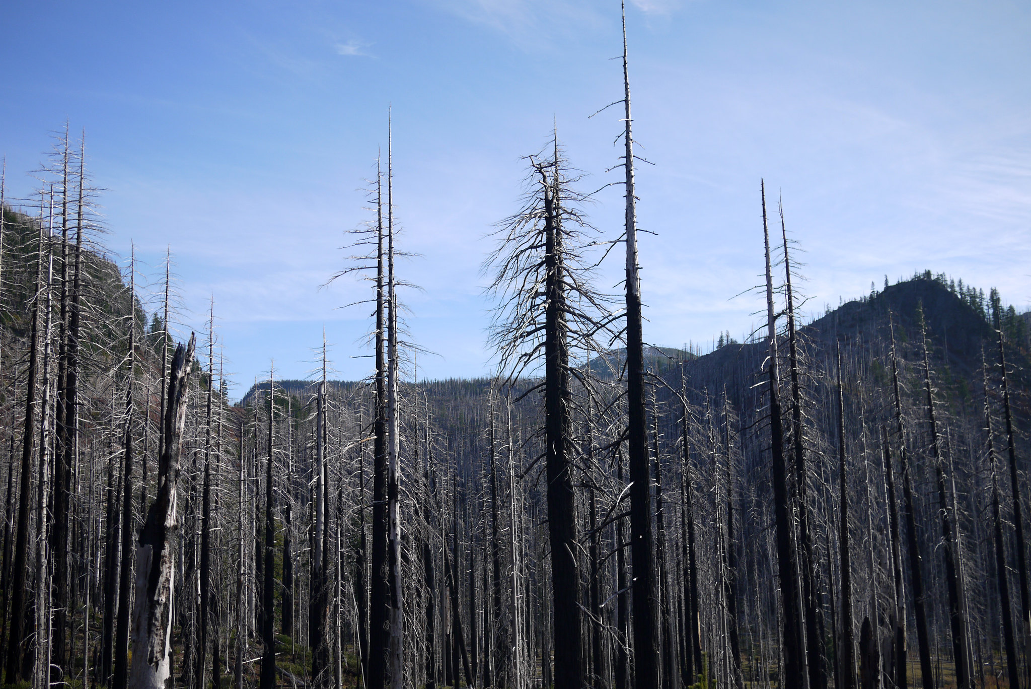
We passed through some beautiful forests in the Cascades, including a section that looked to have been involved in a fire in the relatively recent past.


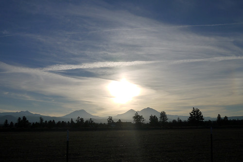
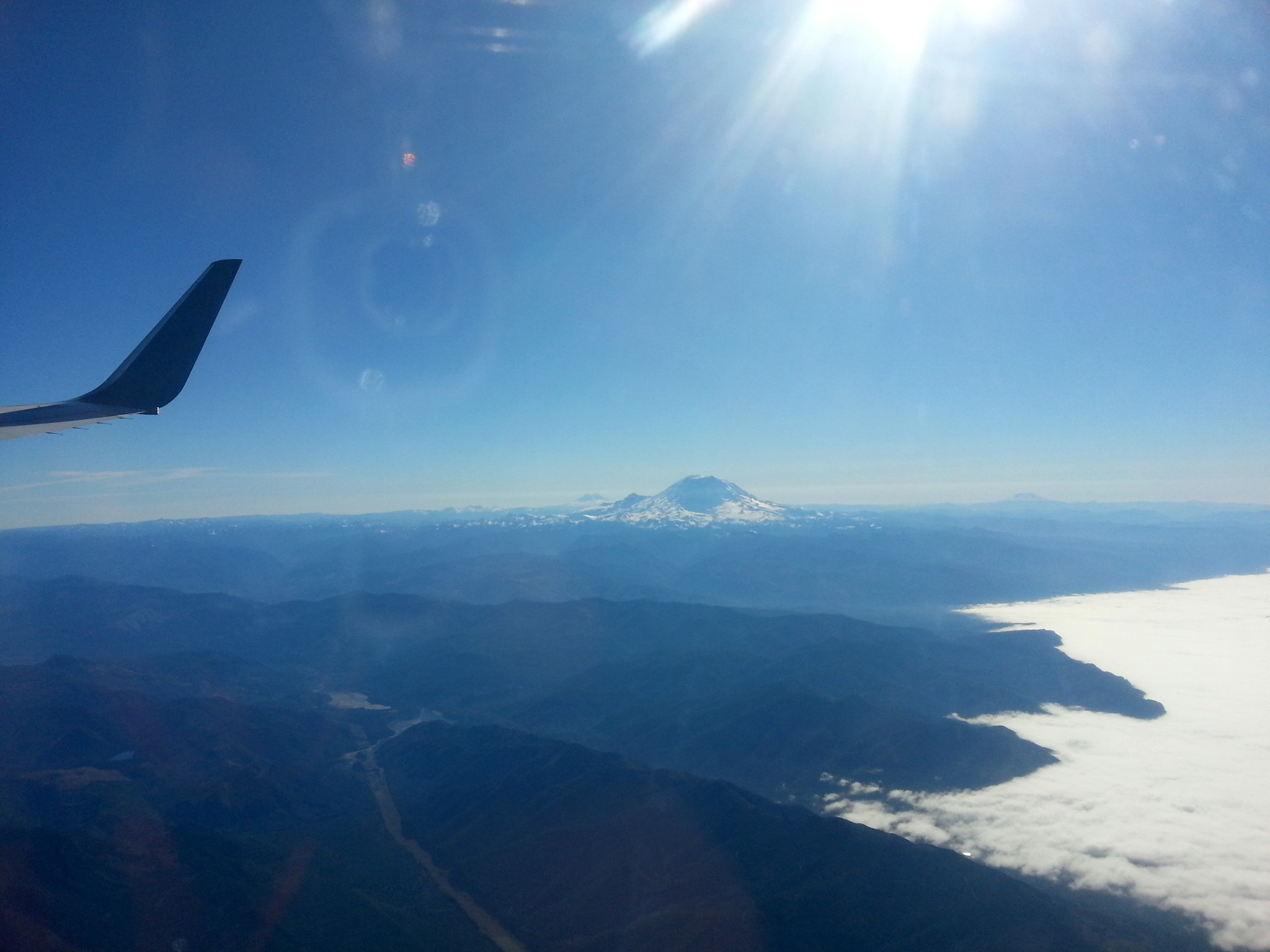
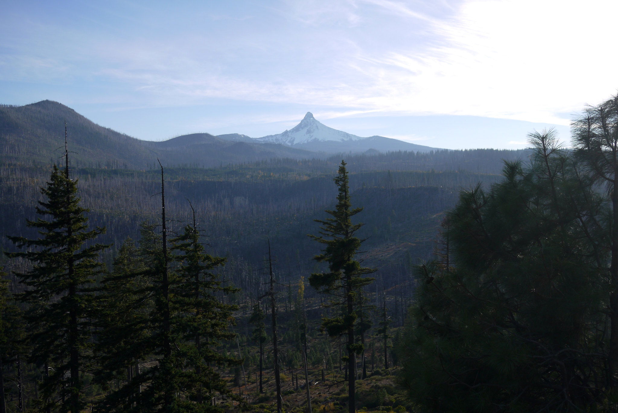
We also caught some great views of Mt.Washington and the surrounding peaks.


We made it to Bend a little later, and had an incredibly delicious (and affordable!) meal of duck fries (fries cooked in duck fat, served with truffle aioli), baby back ribs with truffled mac and cheese, and cocktails. 


roadtrip rehash: day 2 (olympic national park, crescent lake, forks)

The second day of our trip was the first real day of "roadtripping"; we left Seattle via the Bainbridge Island Ferry, to catch 305 up and out of the metro area. We drove into the CARgo (see what I did there?) area of the ferry, which had a view out the far end of the approaching island, that sadly my camera couldn't quite pick up.

 ...and this was the view off the rear deck of the ferry.


Just outside of Seattle, we made a quick stop at Kiana Lodge, where some of the crucial scenes of the pilot episode of Twin Peaks were filmed. If you've seen the show, you'll recognize this as "Laura's Log."


After that, things started to really get Pacific-Northwesterny, with towering evergreens and jagged mountain peaks. The National Parks were closed for the government shutdown, but fortunately, they were letting people drive pretty far into the parks before closing the roads off. We were able to take in some great scenery and saw lots of cars parked off the side of the road (presumably for hiking?)


Although I have a pretty substantial 300mm lens for my camera, switching it out can get pretty cumbersome. Thankfully, my guy brought along binoculars and out of curiosity, I ended up with these creepy voyeuristic images of the peaks in Olympic NP.


After the first stop in Olympic, we headed to Crescent Lake, a property technically within the National Park System. When we arrived, this "sorry we're closed" sign was waiting for us, though fortunately there was no one there to enforce it.


By means of google maps, we determined a western view of the lake was a ten minute walk past the barricades. We weren't sure whether the view would be worth the risk of getting caught, but our curiosity won out, so we left our car and walked right past the "blockade." We were immediately greeted by the most serene, moss-covered forest I've ever seen, which alone was well worth any "risk" we endured.


Just as google hath predicted, ten minutes of walking later, we hit the western portion of a peninsula jutting out into the lake, and had the entirety of it (at least as far as the eye could see) to ourselves.


When we were done poking around the lakeshore, we started a long leisurely drive west on 101 along the lake's southern edge (literally on its edge), then turned south towards Forks, where we spent the night at a lovely B&B.


I was a little under the weather from all the travel, so the pizza we ordered in Forks didn't look super great to me, though my s.o. swears it "wasn't that bad." Lessons learned that day? Minor acts of civil disobedience get rewarded with glacial lakes all to yourself, and if you're ever in Forks, WA, pack a picnic dinner from the grocery store rather than ordering out.

Oh, and Forks is weird. Exhibit (a):