puerto rico is home to the only tropical rainforest in the united states national forest system (weird, seems like surely there'd be one in hawaii too, no?)
there are a million hiking trails that lead through some of the most beautiful vegetation and views, but we decided to do the el yunque peak trail since el yunque peak is the highest point in puerto rico. there were also several side trails to observation towers and a crazy drop off/ledge that were short trips off the main trail... and totally worth the detour.
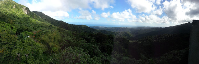
panoramic view from one of the observation towers;
a rain shelter on another one of the side trails;

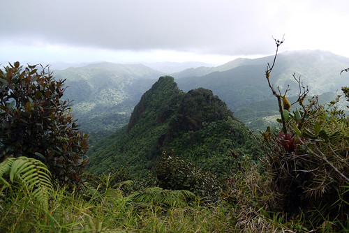
los pinchos (the jagged peak) as seen from a side trail. i almost died of a heart attack after taking this photo when i looked down and realized i was standing literally on the edge of an extremely steep drop-off. no kidding. it's hard to tell in this photo, but the lighter green plants at the bottom of this picture are clinging on to the side of a cliff face, NOT growing out of the ground.
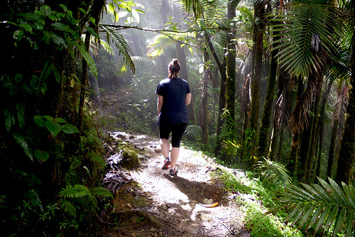
jen, back on the main trail to el yunque peak
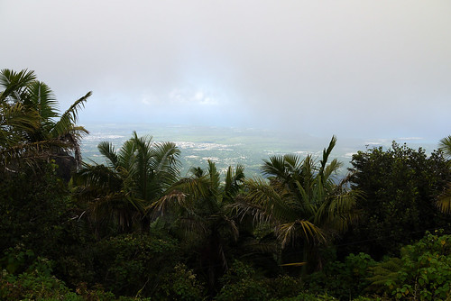
view from the top of el yunque. unfortunately, this spot is apparently always covered in clouds forming off the warm caribbean waters and cooling as they rise over the peaks... it was pretty awesome to see the sun shining in the distance surrounding us though, and then later back at sea level, looking back at the peak and seeing it constantly covered in clouds.
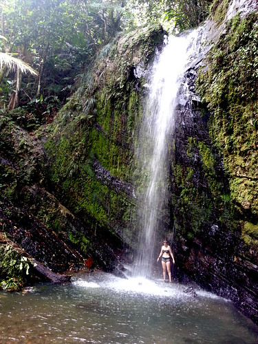
after el yunque peak, we did another, shorter hike, to a series of "hidden waterfalls" -- they aren't super hidden since i easily found directions on the internet before our trip, but they also aren't marked well on the maps and the trail isn't officially blazed. also, the term hike isn't exactly appropriate, it was really more like muddy rock climbing. i'm pretty sure this is when we had an unfortunate encounter with a poisonous plant that, two weeks later, has still left a painful rash on our arms.
the muddy climbing and poisonous plants were totally worth it though, because we ended up at this 40ft waterfall and swimming hole that we had all to ourselves. we didn't even bother going to la mina, which is the main tourist attraction because this spot was so awesome.
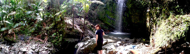
panorama view of the falls... the big rocks in front of jen are concealing a smaller waterfall that led further back down the mountain
there are a million hiking trails that lead through some of the most beautiful vegetation and views, but we decided to do the el yunque peak trail since el yunque peak is the highest point in puerto rico. there were also several side trails to observation towers and a crazy drop off/ledge that were short trips off the main trail... and totally worth the detour.
panoramic view from one of the observation towers;
a rain shelter on another one of the side trails;
los pinchos (the jagged peak) as seen from a side trail. i almost died of a heart attack after taking this photo when i looked down and realized i was standing literally on the edge of an extremely steep drop-off. no kidding. it's hard to tell in this photo, but the lighter green plants at the bottom of this picture are clinging on to the side of a cliff face, NOT growing out of the ground.
jen, back on the main trail to el yunque peak
view from the top of el yunque. unfortunately, this spot is apparently always covered in clouds forming off the warm caribbean waters and cooling as they rise over the peaks... it was pretty awesome to see the sun shining in the distance surrounding us though, and then later back at sea level, looking back at the peak and seeing it constantly covered in clouds.
after el yunque peak, we did another, shorter hike, to a series of "hidden waterfalls" -- they aren't super hidden since i easily found directions on the internet before our trip, but they also aren't marked well on the maps and the trail isn't officially blazed. also, the term hike isn't exactly appropriate, it was really more like muddy rock climbing. i'm pretty sure this is when we had an unfortunate encounter with a poisonous plant that, two weeks later, has still left a painful rash on our arms.
the muddy climbing and poisonous plants were totally worth it though, because we ended up at this 40ft waterfall and swimming hole that we had all to ourselves. we didn't even bother going to la mina, which is the main tourist attraction because this spot was so awesome.
panorama view of the falls... the big rocks in front of jen are concealing a smaller waterfall that led further back down the mountain